


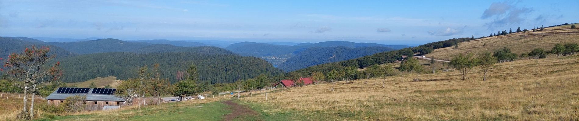
pied du Hohneck - le Kastelbeck

lemuid
User
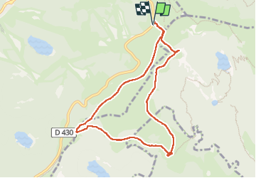

Length
8.6 km

Max alt
1310 m

Uphill gradient
274 m
Km-Effort
12.2 km

Min alt
1156 m

Downhill gradient
275 m
Boucle
Yes
Creation date :
2022-09-07 07:30:32.081
Updated on :
2022-09-07 15:29:07.517
2h49
Difficulty : Easy

FREE GPS app for hiking
 SityTrail
IGN / Geographical institutes
SityTrail Plus
The world is yours!
About
Trail Walking of 8.6 km to be discovered at Grand Est, Vosges, La Bresse. This trail is proposed by lemuid.
Photos


Positioning
Country:
France
Region :
Grand Est
Department/Province :
Vosges
Municipality :
La Bresse
Location:
Unknown
Start:(Dec)
Start:(UTM)
351520 ; 5322216 (32U) N.
Comments